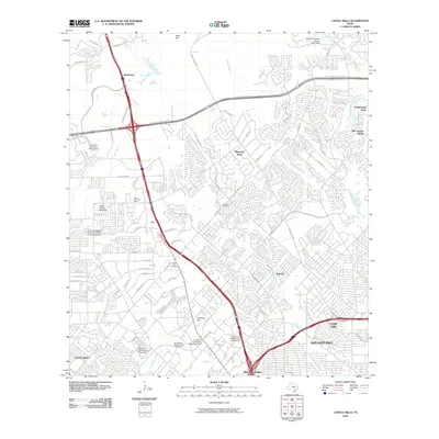
2010 Map of Castle Hills
USGS Topo · Published 2010About this map
San Antonio expands northward into the Texas Hill Country in this early 21st-century record, where established neighborhoods meet significant institutional corridors. The northern reaches are characterized by independent municipalities like Shavano Park and Hollywood Park, while the western edge is dominated by the sprawling University of Texas at San Antonio campus. This era shows a landscape heavily influenced by the Interstate 10 and Loop 1604 corridors, which sparked rapid commercial and residential infill around older landmarks like Locke Hill Cemetery and the Dollar Downs Racetrack.
Find a feature on this map
66 named features on this map. Tap any name to fly to it.
Don’t see what you’re looking for? This feature index may not catch every label — zoom into the map to look around manually.
Map Details
Editions of this 2010 Castle Hills Map
This is the sole edition of this map. No revisions or reprints were ever made.
Other maps of this area

1953 · Otis Ridge
USGS Topo · 1:24,000

1953 · Culebra Hill
USGS Topo · 1:24,000

1953 · San Antonio West
USGS Topo · 1:24,000

1953 · Bulverde
USGS Topo · 1:24,000

1953 · San Antonio East
USGS Topo · 1:24,000

1953 · Longhorn
USGS Topo · 1:24,000

1953 · Helotes
USGS Topo · 1:24,000

1953 · Castle Hills
USGS Topo · 1:24,000

1953 · Van Raub
USGS Topo · 1:24,000

1954 · San Antonio
USGS Topo · 1:250,000