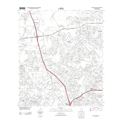
2013 Map of Castle Hills
USGS Topo · Published 2013About this map
Beckmann and Shavano Park anchor the northern reaches of this suburban Bexar County landscape, characterized by the dense residential expansion of San Antonio in the early 21st century. The map traces the intricate network of suburban streets and major transportation corridors, including the intersection of I-10 and I-410. This modern survey documents the significant urbanization around established communities like Castle Hills and Hollywood Park, where residential subdivisions have largely replaced the former agricultural and open ranch lands of south-central Texas. Despite this growth, natural drainage patterns remain visible through the meandering paths of Salado Cr and Leon Cr, which carve through the limestone terrain. Smaller landmarks like Hill Cem near the Olga area and the prominence of Ninemile Hill provide localized historical points of reference amidst the sprawling contemporary infrastructure.
Find a feature on this map
25 named features on this map. Tap any name to fly to it.
Don’t see what you’re looking for? This feature index may not catch every label — zoom into the map to look around manually.
Map Details
Editions of this 2013 Castle Hills Map
This is the sole edition of this map. No revisions or reprints were ever made.
Other maps of this area

1953 · Otis Ridge
USGS Topo · 1:24,000

1953 · Culebra Hill
USGS Topo · 1:24,000

1953 · San Antonio West
USGS Topo · 1:24,000

1953 · Bulverde
USGS Topo · 1:24,000

1953 · San Antonio East
USGS Topo · 1:24,000

1953 · Longhorn
USGS Topo · 1:24,000

1953 · Helotes
USGS Topo · 1:24,000

1953 · Castle Hills
USGS Topo · 1:24,000

1953 · Van Raub
USGS Topo · 1:24,000

1954 · San Antonio
USGS Topo · 1:250,000