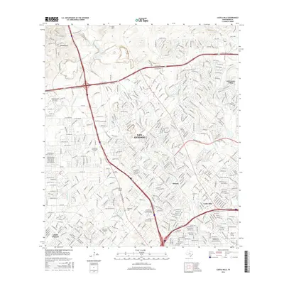
2016 Map of Castle Hills
USGS Topo · Published 2016About this map
San Antonio’s northern residential and institutional growth is the defining characteristic of this landscape, where suburban expansion meets the varied terrain of the Texas Hill Country. The map identifies key educational and religious landmarks such as the The Univ of Texas at San Antonio-Main Campus, the Univ of Phoenix-San Antonio Campus, and the Oblate Sch of Theology. Established communities like Castle Hills and Hill Country Village are shown amidst a complex network of modern infrastructure, including the N Loop 1604 W and N Loop 1604 E.
Find a feature on this map
456 named features on this map. Tap any name to fly to it.
Don’t see what you’re looking for? This feature index may not catch every label — zoom into the map to look around manually.
Map Details
Editions of this 2016 Castle Hills Map
This is the sole edition of this map. No revisions or reprints were ever made.
Other maps of this area

1953 · Otis Ridge
USGS Topo · 1:24,000

1953 · Culebra Hill
USGS Topo · 1:24,000

1953 · San Antonio West
USGS Topo · 1:24,000

1953 · Bulverde
USGS Topo · 1:24,000

1953 · San Antonio East
USGS Topo · 1:24,000

1953 · Longhorn
USGS Topo · 1:24,000

1953 · Helotes
USGS Topo · 1:24,000

1953 · Castle Hills
USGS Topo · 1:24,000

1953 · Van Raub
USGS Topo · 1:24,000

1954 · San Antonio
USGS Topo · 1:250,000