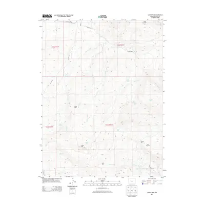
2013 Map of Castle Peak
USGS Topo · Published 2013About this map
Castle Peak and the surrounding high country of Eagle County define this 2013 topographic survey. The landscape is a network of ridges and drainages, including Pisgah Mountain and Horse Mountain, that direct the flow of water through various creek systems. In the higher elevations, water is managed through features like the G G Upper Reservoir and the Leonard Horn Ditch Number 1, reflecting the region's agricultural and irrigation history. This specific map shows how the terrain is accessed through primitive and local roads such as Castle Rd and Catamount Creek Rd. Several small high-altitude bodies of water, such as Schlegel Lake, Picture Lake, and Domanile Lake, are scattered throughout the peaks, while named crossings like Coberly Gap provide passage through the steep topography between Winter Ridge and the major summits.
Find a feature on this map
34 named features on this map. Tap any name to fly to it.
Don’t see what you’re looking for? This feature index may not catch every label — zoom into the map to look around manually.
Map Details
Editions of this 2013 Castle Peak Map
This is the sole edition of this map. No revisions or reprints were ever made.
Other maps of this area

1957 · Leadville
USGS Topo · 1:250,000

1959 · Leadville
USGS Topo · 1:250,000

1960 · Leadville
USGS Topo · 1:250,000

1962 · Leadville
USGS Topo · 1:250,000

1962 · Gypsum
USGS Topo · 1:24,000

1962 · Wolcott
USGS Topo · 1:24,000

1962 · Eagle
USGS Topo · 1:24,000

1964 · Leadville
USGS Topo · 1:250,000
1972 · Mc Coy
USGS Topo · 1:24,000

1972 · Blue Hill
USGS Topo · 1:24,000