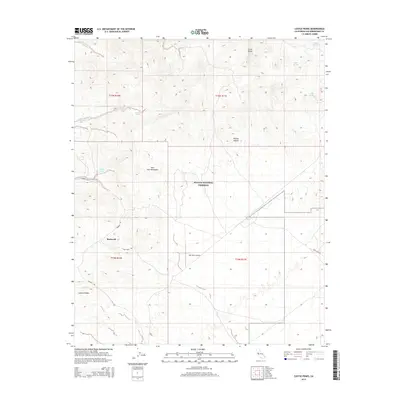
2015 Map of Castle Peaks
USGS Topo · Published 2015About this map
Barnwell sits at a crossroads of high-desert history, where the southern reaches of the New York Mountains meet the northern edge of the Lanfair Valley. This 2015 landscape, largely contained within the Mojave National Preserve, is defined by its scarce water sources such as Bathtub Spring, Dove Spring, and Malpais Springs. The terrain rises sharply to the north at Castle Peaks, while the valley floor is etched by Willow Wash. Transportation through this arid region relies on historic corridors like Ivanpah Rd and Hart Mine Rd, which lead toward the Hart Mine Airport. The map documents a sparsely populated but geographically significant portion of the Mojave Desert, where the legacy of desert ranching and mining is still visible through the placement of remote outposts and named water holes.
Find a feature on this map
19 named features on this map. Tap any name to fly to it.
Don’t see what you’re looking for? This feature index may not catch every label — zoom into the map to look around manually.
Map Details
Editions of this 2015 Castle Peaks Map
This is the sole edition of this map. No revisions or reprints were ever made.
Other maps of this area

1910 · Ivanpah
USGS Topo · 1:250,000

1912 · Ivanpah
USGS Topo · 1:250,000

1942 · Ivanpah
USGS Topo · 1:250,000

1947 · Kingman
USGS Topo · 1:250,000

1948 · Kingman
USGS Topo · 1:250,000

1954 · Kingman
USGS Topo · 1:250,000

1955 · Kingman
USGS Topo · 1:250,000

1955 · Mid Hills
USGS Topo · 1:62,500
1956 · Lanfair Valley
USGS Topo · 1:62,500

1956 · Ivanpah
USGS Topo · 1:62,500