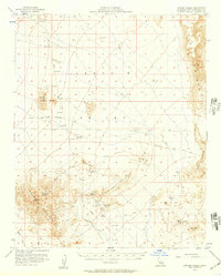
1956 Map of Lanfair Valley
USGS Topo · Published 1957About this map
Mining operations and rugged desert infrastructure define this mid-century survey of the California high desert. The landscape is marked by industrial activity, including the True Blue Mine, California Mine, and the Leiser Ray Mine near Tungsten Flat. These sites are linked by a network of unimproved desert tracks and the historic Old Government Road, which snakes across the terrain toward the Piute Range. The reliance on scarce water sources is evident through the mapping of Hackberry Spring, Vontrigger Spring, and several isolated reservoirs.
Find a feature on this map
27 named features on this map. Tap any name to fly to it.
Don’t see what you’re looking for? This feature index may not catch every label — zoom into the map to look around manually.
Map Details
Editions of this 1956 Lanfair Valley Map
3 editions found
Other maps of this area

1886 · Camp Mohave
USGS Topo · 1:250,000

1892 · Camp Mohave
USGS Topo · 1:250,000

1910 · Ivanpah
USGS Topo · 1:250,000

1912 · Ivanpah
USGS Topo · 1:250,000

1926 · Mohave City
USGS Topo · 1:96,000

1942 · Camp Mohave
USGS Topo · 1:250,000

1942 · Ivanpah
USGS Topo · 1:250,000

1942 · Amboy
USGS Topo · 1:250,000

1943 · Amboy
USGS Topo · 1:250,000

1943 · Fenner
USGS Topo · 1:62,500