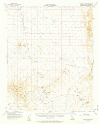
1956 Map of Lanfair Valley
USGS Topo · Published 1963About this map
Lanfair Valley and the surrounding desert peaks are defined by a complex network of mining prospects and historic transit corridors in this mid-century survey. The landscape is marked by the Old Government Road and numerous Jeep Trails that connect remote outposts across the Piute Range and the Vontrigger Hills. Extraction efforts are evident throughout the quadrangle, notably at the True Blue Mine, the California Mine, and the Leiser Ray Mine near the base of Billie Mtn.
Find a feature on this map
28 named features on this map. Tap any name to fly to it.
Don’t see what you’re looking for? This feature index may not catch every label — zoom into the map to look around manually.
Map Details
Editions of this 1956 Lanfair Valley Map
3 editions found
Other maps of this area

1886 · Camp Mohave
USGS Topo · 1:250,000

1892 · Camp Mohave
USGS Topo · 1:250,000

1910 · Ivanpah
USGS Topo · 1:250,000

1912 · Ivanpah
USGS Topo · 1:250,000

1926 · Mohave City
USGS Topo · 1:96,000

1942 · Camp Mohave
USGS Topo · 1:250,000

1942 · Ivanpah
USGS Topo · 1:250,000

1942 · Amboy
USGS Topo · 1:250,000

1943 · Amboy
USGS Topo · 1:250,000

1943 · Fenner
USGS Topo · 1:62,500