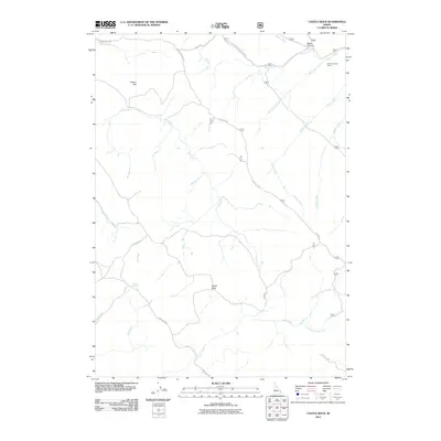
2011 Map of Castle Rock
USGS Topo · Published 2011About this map
Castle Rock stands as a prominent landmark in this 2011 survey of Bonneville County, where the landscape is defined by a dense network of watercourses and forest service routes. The drainage patterns of Lava Creek, Hell Creek, and Monument Creek carve through the terrain, illustrating the complex geography of the Caribou-Targhee National Forest area. Human activity in this rural expanse is marked by specific functional sites such as the Fall Creek Cow Camp near Bates Canyon, alongside natural water sources like Willow Springs. Transport through the region relies on established forest corridors including Skyline Rd and Kepps Crossing Rd, which provide access to higher elevations like Dalton Hill. The map meticulously details the splitting of waterways, such as where North Fork Lava Creek and South Fork Lava Creek diverge, offering a precise look at the hydrology of southeastern Idaho.
Find a feature on this map
24 named features on this map. Tap any name to fly to it.
Don’t see what you’re looking for? This feature index may not catch every label — zoom into the map to look around manually.
Map Details
Editions of this 2011 Castle Rock Map
This is the sole edition of this map. No revisions or reprints were ever made.
Other maps of this area

1917 · Cranes Flat
USGS Topo · 1:62,500

1924 · Hell Creek
USGS Topo · 1:62,500

1926 · Hell Creek
USGS Topo · 1:62,500

1932 · Irwin
USGS Topo · 1:96,000

1935 · Irwin
USGS Topo · 1:125,000

1955 · Driggs
USGS Topo · 1:250,000

1958 · Driggs
USGS Topo · 1:250,000

1962 · Driggs
USGS Topo · 1:250,000

1966 · Conant Valley
USGS Topo · 1:24,000
1966 · Herman
USGS Topo · 1:24,000