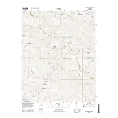
2015 Map of Castle Rock Ridge
USGS Topo · Published 2015About this map
Castle Rock Ridge and the Santa Cruz Mountains dominate this survey of the high ground between the Santa Clara and San Lorenzo valleys. The map traces the prominent San Andreas Fault as it cuts through Lyndon Canyon and near the Lake Ranch Reservoir. This era shows the suburban edge of Saratoga and Monte Sereno meeting the steep, wooded slopes of the range. Along the winding Skyline Blvd, landmarks like Summit Rock and Goat Rock provide orientation for the high ridges. To the south, the terrain descends toward Boulder Creek and the headwaters of the San Lorenzo River. The complex network of canyons, including Harmon Gulch and Hopkins Gulch, highlights the area's transition from residential foothills to protected watershed lands such as Loch Lomond.
Find a feature on this map
109 named features on this map. Tap any name to fly to it.
Don’t see what you’re looking for? This feature index may not catch every label — zoom into the map to look around manually.
Map Details
Editions of this 2015 Castle Rock Ridge Map
This is the sole edition of this map. No revisions or reprints were ever made.
Other maps of this area

1889 · San Jose
USGS Topo · 1:62,500

1897 · San Jose
USGS Topo · 1:62,500

1897 · Palo Alto
USGS Topo · 1:62,500

1899 · San Jose
USGS Topo · 1:62,500

1899 · Palo Alto
USGS Topo · 1:62,500

1902 · Santa Cruz
USGS Topo · 1:125,000

1916 · New Almaden
USGS Topo · 1:48,000

1919 · New Almaden
USGS Topo · 1:62,500

1940 · Los Gatos
USGS Topo · 1:62,500

1941 · Palo Alto
USGS Topo · 1:62,500