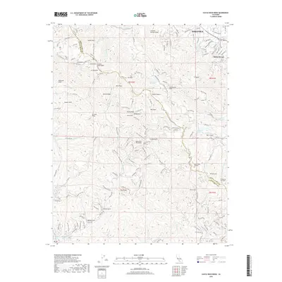
2018 Map of Castle Rock Ridge
USGS Topo · Published 2018About this map
Saratoga and Monte Sereno occupy the northeastern corner of this landscape, where the Santa Clara Valley meets the rising elevations of the Santa Cruz Mountains. The map is dominated by the complex terrain of Castle Rock Ridge and its numerous subsidiary spurs, including Deer Ridge, Damond Ridge, and Beatty Ridge. This area contains a high concentration of prominent geological landmarks such as Summit Rock, Grizzly Rock, and The Peak.
Find a feature on this map
158 named features on this map. Tap any name to fly to it.
Don’t see what you’re looking for? This feature index may not catch every label — zoom into the map to look around manually.
Map Details
Editions of this 2018 Castle Rock Ridge Map
This is the sole edition of this map. No revisions or reprints were ever made.
Other maps of this area

1889 · San Jose
USGS Topo · 1:62,500

1897 · San Jose
USGS Topo · 1:62,500

1897 · Palo Alto
USGS Topo · 1:62,500

1899 · San Jose
USGS Topo · 1:62,500

1899 · Palo Alto
USGS Topo · 1:62,500

1902 · Santa Cruz
USGS Topo · 1:125,000

1916 · New Almaden
USGS Topo · 1:48,000

1919 · New Almaden
USGS Topo · 1:62,500

1940 · Los Gatos
USGS Topo · 1:62,500

1941 · Palo Alto
USGS Topo · 1:62,500