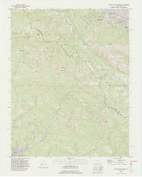
1991 Map of Castle Rock Ridge
USGS Topo · Published 1995About this map
Castle Rock State Park and the ridge-top terrain of the Santa Cruz Mountains dominate this 1991 landscape, defined by sharp elevations and a network of deep gulches. Following the high crest along Skyline Boulevard, the map traces the boundary between Santa Clara and Santa Cruz counties. The area is notable for its numerous named outcrops, including Goat Rock, Summit Rock, and Castle Rock, which served as landmarks long before the establishment of modern park boundaries. To the northeast, the terrain descends toward Saratoga and Monte Sereno, where the grounds of Villa Montalvo Arboretum sit near the edge of the urbanized valley.
Find a feature on this map
56 named features on this map. Tap any name to fly to it.
Don’t see what you’re looking for? This feature index may not catch every label — zoom into the map to look around manually.
Map Details
Editions of this 1991 Castle Rock Ridge Map
2 editions found
Other maps of this area

1889 · San Jose
USGS Topo · 1:62,500

1897 · San Jose
USGS Topo · 1:62,500

1897 · Palo Alto
USGS Topo · 1:62,500

1899 · San Jose
USGS Topo · 1:62,500

1899 · Palo Alto
USGS Topo · 1:62,500

1902 · Santa Cruz
USGS Topo · 1:125,000

1916 · New Almaden
USGS Topo · 1:48,000

1919 · New Almaden
USGS Topo · 1:62,500

1940 · Los Gatos
USGS Topo · 1:62,500

1941 · Palo Alto
USGS Topo · 1:62,500