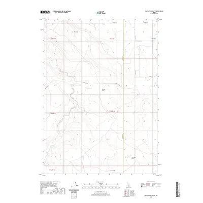
2020 Map of Castleford Butte
USGS Topo · Published 2020About this map
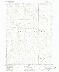
The Bruneau Desert defines this high-desert landscape on the border of Owyhee and Twin Falls Counties. This modern survey illustrates a topography of deep gulches and ridges, where sparse water sources like Hewitt Watering and Freeland Watering were historically vital for land use. The drainage system is dominated by the winding path of Sailor Creek and the sharp incisions of Deadman Gulch and Blue Gulch in the north. The namesake Castleford Butte rises in the southeast corner, standing as a prominent landmark for travelers and surveyors alike. Modern infrastructure, including Balanced Rock Rd and several numbered county routes such as 4300 North Rd, provides access through the expansive sections of the Public Land Survey System, which remains the primary organizing framework for this part of Idaho.
Find a feature on this map
22 named features on this map. Tap any name to fly to it.
Don’t see what you’re looking for? This feature index may not catch every label — zoom into the map to look around manually.
Map Details
Editions of this 2020 Castleford Butte Map
This is the sole edition of this map. No revisions or reprints were ever made.
Other maps of this area

1955 · Twin Falls
USGS Topo · 1:250,000

1958 · Twin Falls
USGS Topo · 1:250,000

1959 · Buhl
USGS Topo · 1:62,500

1959 · Crows Nest
USGS Topo · 1:62,500

1965 · Tuanna Butte
USGS Topo · 1:24,000

1979 · Coonskin Butte NE
USGS Topo · 1:24,000
1979 · Tuanna Butte
USGS Topo · 1:24,000
1980 · Crows Nest
USGS Topo · 1:24,000
1980 · Notch Butte
USGS Topo · 1:24,000
1980 · Castleford Butte
USGS Topo · 1:24,000