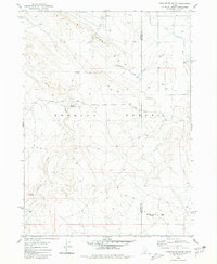
1980 Map of Castleford Butte
USGS Topo · Published 1980About this map
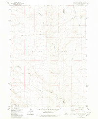
The high desert terrain of the Bruneau Desert and Blue Ridge dominates this 1980 survey, illustrating a landscape primarily shaped by water access and cattle ranching. Essential livestock locations like Hewitt Watering and Freeland Watering are marked alongside isolated infrastructure such as a Corral and a Water Tank. The topography is defined by the sharp incisions of Deadman Creek and Sailor Creek, which carve through the volcanic foundations of the region, including areas of Basalt. The eastern edge of the quadrangle shows the boundary between Owyhee and Twin Falls Counties, where Castleford Butte rises as a prominent landmark. A network of primitive transport is visible via the Jeep Trail system and the Balanced Rock Road, while more modern development is noted by a Radio Facility on the heights.
Find a feature on this map
18 named features on this map. Tap any name to fly to it.
Don’t see what you’re looking for? This feature index may not catch every label — zoom into the map to look around manually.
Map Details
Editions of this 1980 Castleford Butte Map
This is the sole edition of this map. No revisions or reprints were ever made.
Other maps of this area

1955 · Twin Falls
USGS Topo · 1:250,000

1958 · Twin Falls
USGS Topo · 1:250,000

1959 · Buhl
USGS Topo · 1:62,500

1959 · Crows Nest
USGS Topo · 1:62,500

1965 · Tuanna Butte
USGS Topo · 1:24,000

1979 · Coonskin Butte NE
USGS Topo · 1:24,000
1979 · Tuanna Butte
USGS Topo · 1:24,000
1980 · Crows Nest
USGS Topo · 1:24,000
1980 · Notch Butte
USGS Topo · 1:24,000
1980 · Crows Nest NE
USGS Topo · 1:24,000