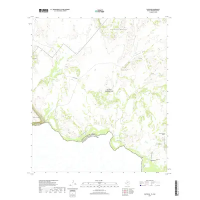
2019 Map of Castolon
USGS Topo · Published 2019About this map
Castolon sits at the heart of this desert landscape along the north bank of the Rio Grande, marking the international boundary between the United States of America and Mexico. This survey of Big Bend National Park shows a region defined by dramatic elevations and seasonal watercourses. To the east, the Chisos Mountains rise sharply, including distinctive peaks like Cerro Castellan and the Cerro Castellan Window. The western portion is dominated by the Mesa de Anguila and the entrance to the Santa Elena Canyon. Historic land use is evidenced by the Castolon Cemetery and Coyote Cemetery, while the Dorgan Sublett Trail provides access to the backcountry near Terlingua Creek. The northern reaches include the Rattlesnake Mountains and Peña Mountain, highlighting the complex topography that defines this borderland.
Find a feature on this map
25 named features on this map. Tap any name to fly to it.
Don’t see what you’re looking for? This feature index may not catch every label — zoom into the map to look around manually.
Map Details
Editions of this 2019 Castolon Map
This is the sole edition of this map. No revisions or reprints were ever made.
Other maps of this area

1903 · Chisos Mountains
USGS Topo · 1:125,000

1903 · Terlingua
USGS Topo · 1:125,000

1904 · Terlingua
USGS Topo · 1:125,000

1905 · Chisos Mountains
USGS Topo · 1:125,000

1959 · Emory Peak
USGS Topo · 1:250,000

1965 · Emory Peak
USGS Topo · 1:250,000

1971 · Terlingua
USGS Topo · 1:24,000

1971 · Cerro Castellan
USGS Topo · 1:24,000

1971 · Amarilla Mountain
USGS Topo · 1:24,000
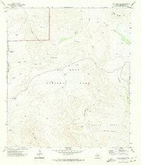
1971 · Tule Mountain
USGS Topo · 1:24,000