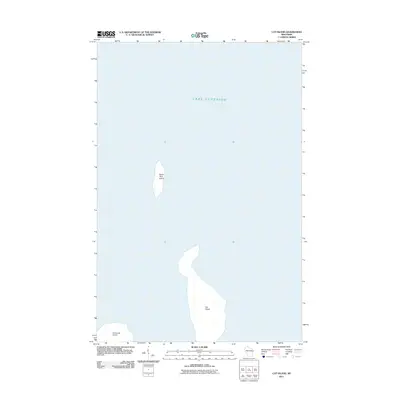
2011 Map of Cat Island
USGS Topo · Published 2011About this map
Lake Superior surrounds a cluster of the Apostle Islands in this 2011 survey, focusing on the isolated landforms of Cat Island and North Twin Island. Located within the waters of Lake Superior, these islands are mapped in high detail, showing the delicate shorelines and internal topography of these northern landmasses. The map also includes the northern tip of Ironwood Island at the bottom edge of the quadrangle. As a modern digital topo, this document reflects the precise surveying of the National Hydrography Dataset and National Elevation Dataset, capturing the exact contours of the islands before changing water levels or natural erosion shifts their boundaries. The absence of roads or structures on these islands highlights their character as protected wilderness and remote maritime landmarks.
Find a feature on this map
4 named features on this map. Tap any name to fly to it.
Don’t see what you’re looking for? This feature index may not catch every label — zoom into the map to look around manually.
Map Details
Editions of this 2011 Cat Island Map
This is the sole edition of this map. No revisions or reprints were ever made.
Other maps of this area

1953 · Ashland
USGS Topo · 1:250,000

1954 · Two Harbors
USGS Topo · 1:250,000

1957 · Two Harbors
USGS Topo · 1:250,000

1958 · Ashland
USGS Topo · 1:250,000

1958 · Two Harbors
USGS Topo · 1:250,000
1963 · Outer Island
USGS Topo · 1:62,500

1963 · Cat Island
USGS Topo · 1:24,000

1963 · Michigan Island
USGS Topo · 1:24,000

1963 · Rocky Island
USGS Topo · 1:62,500
1963 · Outer Island
USGS Topo · 1:24,000