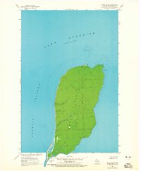
1963 Map of Outer Island
USGS Topo · Published 1965About this map
Outer Island, the northernmost point of the Apostle Islands chain, is documented here in its mid-century state. The landscape is dominated by the heavily wooded interior of the island, which is bisected by the Fourth Principal Meridian. At the northern tip, the Outer Island Light serves as a critical maritime landmark for vessels navigating the open waters of Lake Superior. The surrounding waters reveal complex underwater topography, including the shallow Outer Island Shoal and the sheltered Austad Bay on the eastern shore. Towards the south, the island narrows to the distinctive Sand Point. This 1963 field examination provides a clear look at the island's natural isolation and its role as a sentinel within the archipelago before the establishment of the national lakeshore.
Find a feature on this map
10 named features on this map. Tap any name to fly to it.
Don’t see what you’re looking for? This feature index may not catch every label — zoom into the map to look around manually.
Map Details
Editions of this 1963 Outer Island Map
This is the sole edition of this map. No revisions or reprints were ever made.
Other maps of this area

1953 · Ashland
USGS Topo · 1:250,000

1954 · Two Harbors
USGS Topo · 1:250,000

1957 · Two Harbors
USGS Topo · 1:250,000

1958 · Ashland
USGS Topo · 1:250,000

1958 · Two Harbors
USGS Topo · 1:250,000
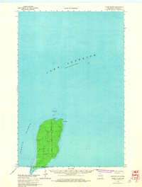
1963 · Outer Island
USGS Topo · 1:62,500

1963 · Cat Island
USGS Topo · 1:24,000

1963 · Michigan Island
USGS Topo · 1:24,000

1963 · Rocky Island
USGS Topo · 1:62,500
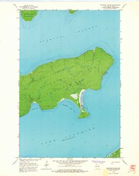
1963 · Stockton Island
USGS Topo · 1:24,000