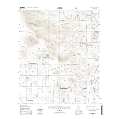
2014 Map of Cat Mountain
USGS Topo · Published 2014About this map
Tucson Estates and the western edge of Tucson are defined by the dramatic transition from the Santa Cruz Valley to the peaks of the Tucson Mountains. The landscape is a network of suburban development and desert preservation, where residential grids like Drexel Heights and Valencia West meet the foothills of Cat Mountain and Golden Gate Mtn. Critical infrastructure is visible in the form of the Central Arizona Project Aqueduct, cutting across the terrain toward the Saginaw Hill area. Outdoor recreation and local geography are highlighted by a dense system of pathways, including the Yetman Trail, Starr Pass Trail, and Rock Wren Trail, which navigate the passes between summits like Bushmaster Peak and Tumamoc Hill. The map also captures the essential transit corridors that connect these desert communities, such as W Ajo Hwy and W Gates Pass Rd.
Find a feature on this map
45 named features on this map. Tap any name to fly to it.
Don’t see what you’re looking for? This feature index may not catch every label — zoom into the map to look around manually.
Map Details
Editions of this 2014 Cat Mountain Map
This is the sole edition of this map. No revisions or reprints were ever made.
Other maps of this area

1904 · Tucson
USGS Topo · 1:125,000

1905 · Tucson
USGS Topo · 1:125,000

1925 · San Xavier
USGS Topo · 1:62,500

1934 · Tucson Mountains
USGS Topo · 1:125,000

1943 · San Xavier Mission
USGS Topo · 1:62,500

1947 · Cortaro
USGS Topo · 1:62,500

1948 · Tucson
USGS Topo · 1:62,500

1956 · Tucson
USGS Topo · 1:250,000

1957 · San Xavier Mission
USGS Topo · 1:62,500

1957 · Tucson
USGS Topo · 1:24,000