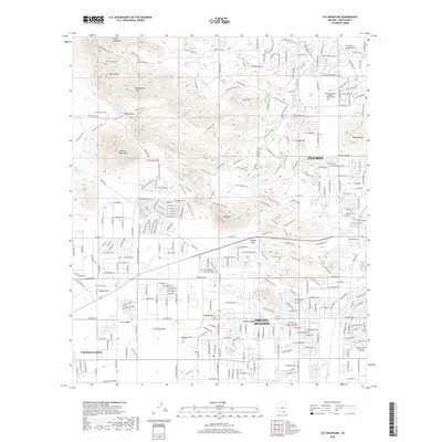
2018 Map of Cat Mountain
USGS Topo · Published 2018About this map
Tucson spreads westward across the valley floor toward the foothills of the Tucson Mountains in this modern topographic study. The landscape is defined by its dramatic transition from urban residential grids in Drexel Heights and Valencia West to the sharp relief of landmarks like Tumamoc Hill and Golden Gate Mtn. Critical infrastructure is visible throughout the area, notably the Central Arizona Project Aqueduct cutting across the desert floor and the W Br Santa Cruz River tracing the eastern edge. For local history enthusiasts, the map provides a contemporary view of the Pima Community College - West Campus and the extensive recreational trail network through Robles Pass and Gates Pass. The contrast between established neighborhoods and the preserved desert mountain peaks illustrates the modern geography of the Avra Valley region.
Find a feature on this map
151 named features on this map. Tap any name to fly to it.
Don’t see what you’re looking for? This feature index may not catch every label — zoom into the map to look around manually.
Map Details
Editions of this 2018 Cat Mountain Map
This is the sole edition of this map. No revisions or reprints were ever made.
Other maps of this area

1904 · Tucson
USGS Topo · 1:125,000

1905 · Tucson
USGS Topo · 1:125,000

1925 · San Xavier
USGS Topo · 1:62,500

1934 · Tucson Mountains
USGS Topo · 1:125,000

1943 · San Xavier Mission
USGS Topo · 1:62,500

1947 · Cortaro
USGS Topo · 1:62,500

1948 · Tucson
USGS Topo · 1:62,500

1956 · Tucson
USGS Topo · 1:250,000

1957 · San Xavier Mission
USGS Topo · 1:62,500

1957 · Tucson
USGS Topo · 1:24,000