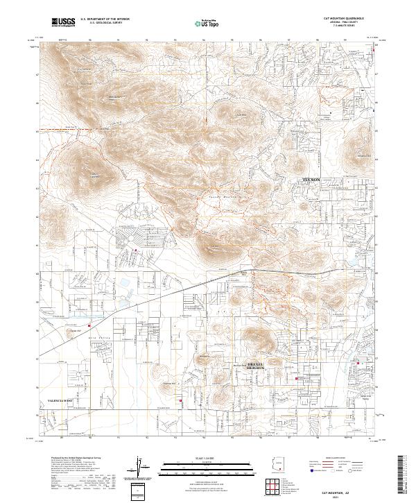
2021 Map of Cat Mountain
USGS Topo · Published 2021About this map
The Tucson Mountains dominate the landscape west of Tucson, where peaks like Tower Peak and Golden Gate Mtn overlook the evolving desert floor. The 2021 topography illustrates a complex meeting of rugged terrain and suburban growth, with the winding Gates Pass providing a critical corridor through the range. To the east, the sprawling Pima Community College - West Campus and the historic Tumamoc Hill mark the transition toward the city center. In the south, the Central Arizona Project Aqueduct cuts a distinct path across the Avra Valley, highlighting the modern infrastructure necessary to support the expanding residential developments of Drexel Heights and Valencia West. The map also details numerous hiking routes like the Yetman Trl and Golden Gate Trl, which navigate the steep elevations between Red Butte and Beehive Peak.
Find a feature on this map
249 named features on this map. Tap any name to fly to it.
Don’t see what you’re looking for? This feature index may not catch every label — zoom into the map to look around manually.
Map Details
Editions of this 2021 Cat Mountain Map
This is the sole edition of this map. No revisions or reprints were ever made.
Other maps of this area

1904 · Tucson
USGS Topo · 1:125,000

1905 · Tucson
USGS Topo · 1:125,000

1925 · San Xavier
USGS Topo · 1:62,500

1934 · Tucson Mountains
USGS Topo · 1:125,000

1943 · San Xavier Mission
USGS Topo · 1:62,500

1947 · Cortaro
USGS Topo · 1:62,500

1948 · Tucson
USGS Topo · 1:62,500

1956 · Tucson
USGS Topo · 1:250,000

1957 · San Xavier Mission
USGS Topo · 1:62,500

1957 · Tucson
USGS Topo · 1:24,000