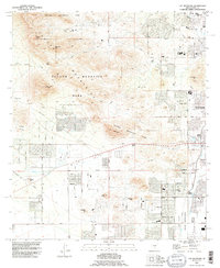
1992 Map of Cat Mountain
USGS Topo · Published 1995About this map
Tucson Mountain Park dominates this western desert landscape, where the high peaks of the Tucson Mountains meet the expanding urban periphery of Tucson. By the early 1990s, residential development is visible pressing toward the rugged terrain of Cat Mountain and Sentinel Peak, while the San Joaquin Aqueduct and numerous irrigation ditches underscore the vital role of water management in the region. The map captures the meeting point of conservation and development, with the San Xavier Indian Reservation bordering the southern reaches near Saginaw Hill. Researchers can trace the path of the West Branch Santa Cruz River and find cultural markers like Pima Community College and the Amphitheater near John F Kennedy Parkway. The presence of several pits and quarries near Snyder Hill points to the area's ongoing extractive history amidst its natural landmarks.
Find a feature on this map
57 named features on this map. Tap any name to fly to it.
Don’t see what you’re looking for? This feature index may not catch every label — zoom into the map to look around manually.
Map Details
Editions of this 1992 Cat Mountain Map
This is the sole edition of this map. No revisions or reprints were ever made.
Other maps of this area

1904 · Tucson
USGS Topo · 1:125,000

1905 · Tucson
USGS Topo · 1:125,000

1925 · San Xavier
USGS Topo · 1:62,500

1934 · Tucson Mountains
USGS Topo · 1:125,000

1943 · San Xavier Mission
USGS Topo · 1:62,500

1947 · Cortaro
USGS Topo · 1:62,500

1948 · Tucson
USGS Topo · 1:62,500

1956 · Tucson
USGS Topo · 1:250,000

1957 · San Xavier Mission
USGS Topo · 1:62,500

1957 · Tucson
USGS Topo · 1:24,000