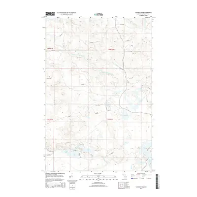
2014 Map of Cataract Basin
USGS Topo · Published 2014About this map
Cataract Basin defines the central hydrology of this Marquette County landscape, where the Middle Branch Escanaba River winds through a network of small creeks and wetlands. In the eastern portion, the Cataract Dam Falls mark a point of significant water movement near the junction of several local routes. The area is characterized by numerous glacial lakes, including Shag Lake, Little Shag Lake, and Pike Lake, which are often accessed by specialized trails like the Chain Lake Trl and Bear Creek Trl. Cultural history is anchored by the Bakkala Cem located near M-35 and Green Creek Rd. The map illustrates a transition from the larger river system to the south, where Chandler Brook and Miller Cr feed into lower-lying basins, creating a complex web of waterways used for recreation and local drainage.
Find a feature on this map
58 named features on this map. Tap any name to fly to it.
Don’t see what you’re looking for? This feature index may not catch every label — zoom into the map to look around manually.
Map Details
Editions of this 2014 Cataract Basin Map
This is the sole edition of this map. No revisions or reprints were ever made.
Other maps of this area

1932 · Helena NW
USGS Topo · 1:31,680

1932 · Harvey NW
USGS Topo · 1:31,680

1932 · Harvey SW
USGS Topo · 1:31,680

1951 · Helena NW
USGS Topo · 1:31,680

1952 · Sands
USGS Topo · 1:24,000

1952 · Ishpeming
USGS Topo · 1:62,500

1952 · Ishpeming
USGS Topo · 1:24,000

1952 · Gwinn
USGS Topo · 1:62,500

1952 · Palmer
USGS Topo · 1:24,000

1952 · Gwinn
USGS Topo · 1:24,000