1976 Map of Catawba
USGS Topo · Published 1978About this map
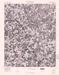
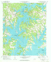
Catawba sits at the heart of this mid-1970s orthophotograph, where the landscape is defined by a dense patchwork of agricultural clearings and forested woodlots. The Catawba River winds through the northern portion of the quadrangle, feeding into the upper reaches of Buffalo Lake Norman. This aerial perspective provides an unfiltered view of the rural Piedmont during a period of transition, showing the exact footprint of small crossroads and community centers like Bandy and the landmark Murrays Mill. Unlike a traditional line-drawn map, this photographic record documents the precise texture of the land, from individual farmstead outbuildings to the intricate drainage patterns that feed the river system, capturing the area's spatial organization just before late-twentieth-century development began to alter the traditional rural character of the county.
Find a feature on this map
5 named features on this map. Tap any name to fly to it.
Don’t see what you’re looking for? This feature index may not catch every label — zoom into the map to look around manually.
Map Details
Editions of this 1976 Catawba Map
This is the sole edition of this map. No revisions or reprints were ever made.
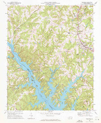
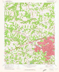
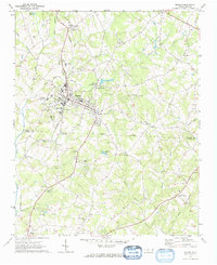
Other maps of this area

1893 · Statesville
USGS Topo · 1:125,000

1895 · Hickory
USGS Topo · 1:125,000

1953 · Charlotte
USGS Topo · 1:250,000

1954 · Charlotte
USGS Topo · 1:250,000

1960 · Charlotte
USGS Topo · 1:250,000

1962 · Charlotte
USGS Topo · 1:250,000
1969 · Troutman
USGS Topo · 1:24,000
1969 · Statesville West
USGS Topo · 1:24,000
1970 · Maiden
USGS Topo · 1:24,000
1970 · Lake Norman North
USGS Topo · 1:24,000