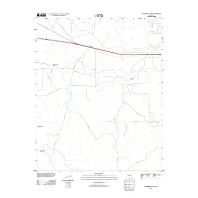
2011 Map of Cathedral Caves
USGS Topo · Published 2011About this map
Pinaveta sits along a prominent transportation corridor in this high-desert landscape of Yavapai County, where an Old Railroad Bed traces the historical path of rail infrastructure across the terrain. The map captures a transition in land use, showing the emerging residential layout of Juniper Woods with its grid of named streets like Christmas Tree Ln and Louise Ln contrasting against the expansive ranching and grazing land. The drainage network is well-defined by Eightmile Creek and Partridge Creek, which feed into numerous livestock watering points such as Williscroft Tank and Jumbo Tank. Significant topographical landmarks including Smith Butte and the deep incision of Butcher Knife Canyon provide clear reference points for those studying the physical geography and ranching history of the region northwest of Ash Fork.
Find a feature on this map
43 named features on this map. Tap any name to fly to it.
Don’t see what you’re looking for? This feature index may not catch every label — zoom into the map to look around manually.
Map Details
Editions of this 2011 Cathedral Caves Map
This is the sole edition of this map. No revisions or reprints were ever made.
Other maps of this area

1886 · Chino
USGS Topo · 1:250,000

1891 · Chino
USGS Topo · 1:250,000

1922 · Williams
USGS Topo · 1:125,000

1947 · Ash Fork
USGS Topo · 1:62,500

1947 · Picacho Butte
USGS Topo · 1:62,500

1948 · Ash Fork
USGS Topo · 1:63,360

1948 · Williams
USGS Topo · 1:250,000

1948 · Picacho Butte
USGS Topo · 1:63,360

1949 · Ash Fork
USGS Topo · 1:62,500

1950 · Picacho Butte
USGS Topo · 1:62,500