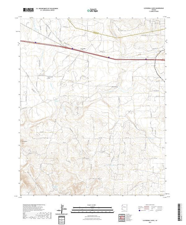
2021 Map of Cathedral Caves
USGS Topo · Published 2021About this map
Pinaveta sits within a landscape defined by an intricate network of washes and livestock tanks along the boundary of Yavapai and Coconino counties. The terrain is marked by significant topographical shifts, from the broad elevation of Big Black Mesa to the dramatic descent of Butcher Knife Canyon and Tom Lockett Draw. The mapping of Numerous water sources, including Williscraft Tank, Wheeler Tank, and Cathedral Tank, suggests the region's reliance on managed water for ranching operations in this arid environment. The presence of the Old Railroad Bed and Gleed Station Rd provides a look at the historical transit corridor that once supported movement through this high-desert plateau. Local roads like Lowe Ranch Rd and Bernadines Way connect the isolated ranching settlements and landmarks, while features like Smith Butte serve as primary navigational points across the drainage basins of Partridge Cr and Eightmile Cr.
Find a feature on this map
79 named features on this map. Tap any name to fly to it.
Don’t see what you’re looking for? This feature index may not catch every label — zoom into the map to look around manually.
Map Details
Editions of this 2021 Cathedral Caves Map
This is the sole edition of this map. No revisions or reprints were ever made.
Other maps of this area

1886 · Chino
USGS Topo · 1:250,000

1891 · Chino
USGS Topo · 1:250,000

1922 · Williams
USGS Topo · 1:125,000

1947 · Ash Fork
USGS Topo · 1:62,500

1947 · Picacho Butte
USGS Topo · 1:62,500

1948 · Ash Fork
USGS Topo · 1:63,360

1948 · Williams
USGS Topo · 1:250,000

1948 · Picacho Butte
USGS Topo · 1:63,360

1949 · Ash Fork
USGS Topo · 1:62,500

1950 · Picacho Butte
USGS Topo · 1:62,500