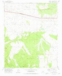
1973 Map of Cathedral Caves
USGS Topo · Published 1976About this map
Big Black Mesa dominates the southern half of this mid-1970s survey, a massive high-elevation plateau overlooking the complex drainages of Eightmile Creek and Partridge Creek. The landscape transition is marked by geological and archaeological points of interest, including the namesake Cathedral Caves and the prominent height of Smith Butte. Water management in this arid Yavapai County terrain is evident through numerous stock tanks like Little Pineveta Tank and Williscraft Tank, supporting the local ranching economy.
Find a feature on this map
22 named features on this map. Tap any name to fly to it.
Don’t see what you’re looking for? This feature index may not catch every label — zoom into the map to look around manually.
Map Details
Editions of this 1973 Cathedral Caves Map
This is the sole edition of this map. No revisions or reprints were ever made.
Other maps of this area

1886 · Chino
USGS Topo · 1:250,000

1891 · Chino
USGS Topo · 1:250,000

1922 · Williams
USGS Topo · 1:125,000

1947 · Ash Fork
USGS Topo · 1:62,500

1947 · Picacho Butte
USGS Topo · 1:62,500

1948 · Ash Fork
USGS Topo · 1:63,360

1948 · Williams
USGS Topo · 1:250,000

1948 · Picacho Butte
USGS Topo · 1:63,360

1949 · Ash Fork
USGS Topo · 1:62,500

1950 · Picacho Butte
USGS Topo · 1:62,500