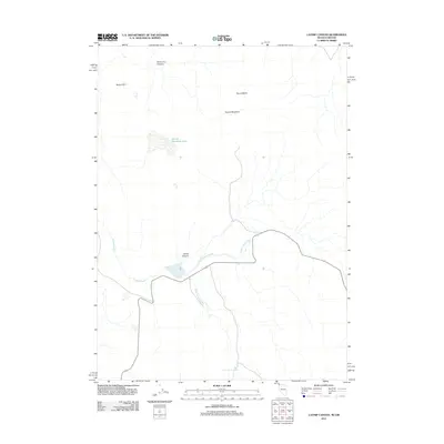
2011 Map of Catnip Canyon
USGS Topo · Published 2011About this map
Catnip Reservoir and the surrounding drainage basin define this high-desert landscape in northwestern Nevada. The area is characterized by seasonal water sources and distinct landforms such as Guano Rim and Round Mountain. Hydrological features are central to the terrain, with Catnip Creek, North Catnip Creek, and South Catnip Creek converging in the vicinity of Catnip Canyon. To the north, Round Mountain Lake and Round Butte mark the high plateau near State Line Canyon. This 2011 survey documents the presence of Little Catnip Spring, a critical water point in an arid environment, highlighting the continued importance of natural springs and managed reservoirs for the region's land use and ecological management.
Find a feature on this map
11 named features on this map. Tap any name to fly to it.
Don’t see what you’re looking for? This feature index may not catch every label — zoom into the map to look around manually.
Map Details
Editions of this 2011 Catnip Canyon Map
This is the sole edition of this map. No revisions or reprints were ever made.
Other maps of this area

1889 · Long Valley
USGS Topo · 1:250,000

1954 · Vya
USGS Topo · 1:250,000

1955 · Adel
USGS Topo · 1:250,000

1957 · Adel
USGS Topo · 1:250,000

1958 · Vya
USGS Topo · 1:250,000

1958 · Adel
USGS Topo · 1:250,000

1962 · Vya
USGS Topo · 1:250,000

1962 · Adel
USGS Topo · 1:250,000

1966 · Catnip Canyon
USGS Topo · 1:24,000

1966 · Bald Mountain
USGS Topo · 1:24,000