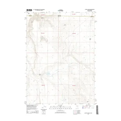
2015 Map of Catnip Canyon
USGS Topo · Published 2015About this map
Guano Valley and the sharp rise of the Guano Rim define this arid borderland between Washoe County and the Oregon state line. In the high desert of the 2010s, water sources remain the primary landmarks for navigation and land use. The drainage system of Catnip Cr, including N Catnip Cr and S Catnip Cr, feeds into the centrally located Catnip Reservoir, a critical point of interest in the deep incision of Catnip Canyon. To the north, the landscape transitions into the distinctive N Rock Springs Table and the high summit of Round Mtn. The presence of Little Catnip Spring near the southern base of Catnip Mtn further illustrates the sparse but vital hydrology of this Great Basin environment. Mapping these natural features reveals the topographical challenges faced by early ranchers and current land managers in this remote section of northern Nevada.
Find a feature on this map
22 named features on this map. Tap any name to fly to it.
Don’t see what you’re looking for? This feature index may not catch every label — zoom into the map to look around manually.
Map Details
Editions of this 2015 Catnip Canyon Map
This is the sole edition of this map. No revisions or reprints were ever made.
Other maps of this area

1889 · Long Valley
USGS Topo · 1:250,000

1954 · Vya
USGS Topo · 1:250,000

1955 · Adel
USGS Topo · 1:250,000

1957 · Adel
USGS Topo · 1:250,000

1958 · Vya
USGS Topo · 1:250,000

1958 · Adel
USGS Topo · 1:250,000

1962 · Vya
USGS Topo · 1:250,000

1962 · Adel
USGS Topo · 1:250,000

1966 · Catnip Canyon
USGS Topo · 1:24,000

1966 · Bald Mountain
USGS Topo · 1:24,000