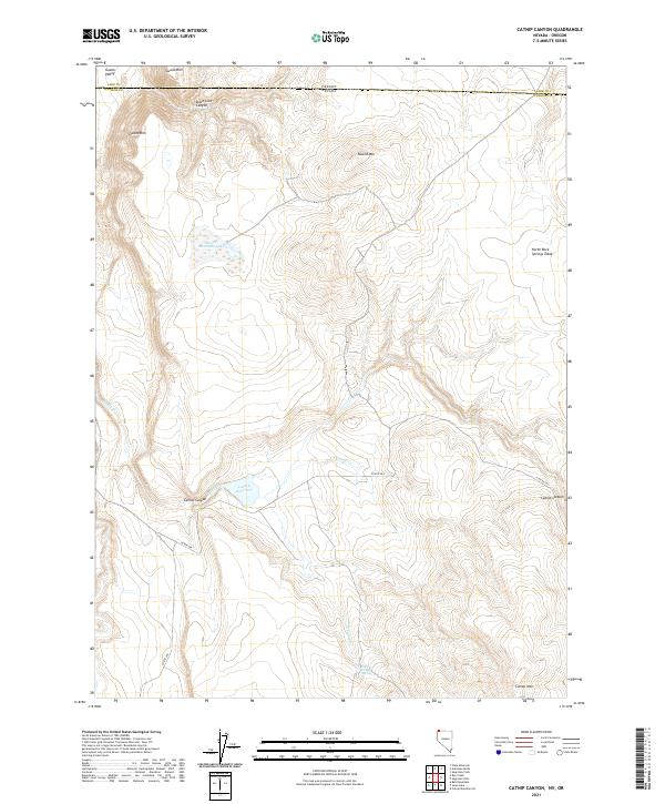
2021 Map of Catnip Canyon
USGS Topo · Published 2021About this map
Guano Rim and the Guano Valley define the northwestern corner of this remote High Desert landscape, where the Oregon and Nevada state line bisects State Line Canyon. This 2021 U.S. Geological Survey representation of northwestern Washoe County shows a terrain shaped by sparse water sources and topographic extremes, from the heights of Catnip Mtn to the depressions of Round Mountain Lake. The central corridor is anchored by Catnip Reservoir, a vital water management point for this arid region, fed by the seasonal drainage of Catnip Cr and its northern and southern forks. Human presence is marked primarily by Co Rte 34a, which provides the only major access through the Catnip Canyon gap. Local hydrology is further detailed by the mention of Little Catnip Spring, a feature critical for wildlife and ranching history in the high plateaus of the North Rock Springs Table.
Find a feature on this map
22 named features on this map. Tap any name to fly to it.
Don’t see what you’re looking for? This feature index may not catch every label — zoom into the map to look around manually.
Map Details
Editions of this 2021 Catnip Canyon Map
This is the sole edition of this map. No revisions or reprints were ever made.
Other maps of this area

1889 · Long Valley
USGS Topo · 1:250,000

1954 · Vya
USGS Topo · 1:250,000

1955 · Adel
USGS Topo · 1:250,000

1957 · Adel
USGS Topo · 1:250,000

1958 · Vya
USGS Topo · 1:250,000

1958 · Adel
USGS Topo · 1:250,000

1962 · Vya
USGS Topo · 1:250,000

1962 · Adel
USGS Topo · 1:250,000

1966 · Catnip Canyon
USGS Topo · 1:24,000

1966 · Bald Mountain
USGS Topo · 1:24,000