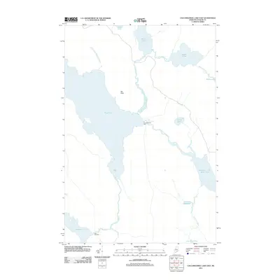
2011 Map of Caucomgomoc Lake East
USGS Topo · Published 2011About this map
Caucomgomoc Dam stands as a central point of water management in this northern Piscataquis County landscape, controlling the flow where the large basin of Rowe Pond meets Caucomgomoc Stream. The terrain is defined by a dense network of connected waterways, including the turbulent stretch of water known as The Horserace and the winding course of Ciss Stream. To the south, Loon Lake Dam regulates the headwaters of Loon Stream, while Sap Ridge provides a significant topographic spine between the lake basins. This 2011 survey captures a remote timberland environment where the industrial history of Maine's North Woods—specifically its reliance on dammed lakes for log driving and water storage—is still clearly etched into the geography through features like Little Scott Deadwater and Daggett Pond.
Find a feature on this map
21 named features on this map. Tap any name to fly to it.
Don’t see what you’re looking for? This feature index may not catch every label — zoom into the map to look around manually.
Map Details
Editions of this 2011 Caucomgomoc Lake East Map
This is the sole edition of this map. No revisions or reprints were ever made.
Other maps of this area

1954 · Chesuncook
USGS Topo · 1:62,500

1954 · Caucomgomoc Lake
USGS Topo · 1:62,500

1954 · Churchill Lake
USGS Topo · 1:62,500

1954 · Allagash Lake
USGS Topo · 1:62,500

1954 · Presque Isle
USGS Topo · 1:250,000

1958 · Presque Isle
USGS Topo · 1:250,000

1958 · Chesuncook
USGS Topo · 1:62,500

1958 · Caucomgomoc Lake
USGS Topo · 1:62,500

1960 · Presque Isle
USGS Topo · 1:250,000

1961 · Allagash Lake
USGS Topo · 1:62,500