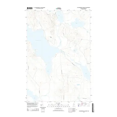
2014 Map of Caucomgomoc Lake East
USGS Topo · Published 2014About this map
Caucomgomoc Lake dominates this northern Maine landscape, serving as the central basin for a complex network of waterways including Loon Stream and Ciss Stream. This 2014 survey captures the remote character of the T7 R14 WELS township, where the drainage of Little Scott Deadwater and the narrow passage known as The Horserace on Caucomgomoc Stream reveal the intricate hydrology of the Maine North Woods. The map shows a region shaped by timber management and seasonal access, indicated by roads like Caucomgomoc Dam Rd and the Black Pond Winter Rd. These routes and features such as Sap Ridge provide essential context for understanding the commercial and recreational movement through these woods, connecting points like Poland Pond in the north to Loon Lake at the southern edge.
Find a feature on this map
26 named features on this map. Tap any name to fly to it.
Don’t see what you’re looking for? This feature index may not catch every label — zoom into the map to look around manually.
Map Details
Editions of this 2014 Caucomgomoc Lake East Map
This is the sole edition of this map. No revisions or reprints were ever made.
Other maps of this area

1954 · Chesuncook
USGS Topo · 1:62,500

1954 · Caucomgomoc Lake
USGS Topo · 1:62,500

1954 · Churchill Lake
USGS Topo · 1:62,500

1954 · Allagash Lake
USGS Topo · 1:62,500

1954 · Presque Isle
USGS Topo · 1:250,000

1958 · Presque Isle
USGS Topo · 1:250,000

1958 · Chesuncook
USGS Topo · 1:62,500

1958 · Caucomgomoc Lake
USGS Topo · 1:62,500

1960 · Presque Isle
USGS Topo · 1:250,000

1961 · Allagash Lake
USGS Topo · 1:62,500