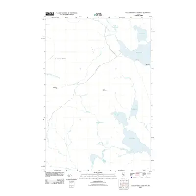
2011 Map of Caucomgomoc Lake West
USGS Topo · Published 2011About this map
Caucomgomoc Mountain and Hurd Mountain dominate the terrain of this north woods landscape, where timber management and remote waterways define the character of the land. This 2011 survey illustrates a region shaped by its glacial history, featuring a dense network of water bodies including Loon Lake, Big Hurd Pond, and Rowe Pond. Transportation through this area is facilitated by industrial forest routes such as St John Pond Depot Rd and Caucomgomoc Rd, which connect various drainage basins. The presence of Telephone Hill suggests a history of overlook or communication points within the high country, while numerous smaller features like Bear Brook Bog and Avery Pond indicate the complex hydrology typical of Somerset County's interior wilderness.
Find a feature on this map
23 named features on this map. Tap any name to fly to it.
Don’t see what you’re looking for? This feature index may not catch every label — zoom into the map to look around manually.
Map Details
Editions of this 2011 Caucomgomoc Lake West Map
This is the sole edition of this map. No revisions or reprints were ever made.
Other maps of this area

1954 · Baker Lake
USGS Topo · 1:62,500

1954 · Caucomgomoc Lake
USGS Topo · 1:62,500

1954 · Allagash Lake
USGS Topo · 1:62,500

1954 · St. John Pond
USGS Topo · 1:62,500

1954 · Presque Isle
USGS Topo · 1:250,000

1958 · Presque Isle
USGS Topo · 1:250,000

1958 · Caucomgomoc Lake
USGS Topo · 1:62,500

1958 · Saint John Pond
USGS Topo · 1:62,500

1960 · Presque Isle
USGS Topo · 1:250,000

1961 · Allagash Lake
USGS Topo · 1:62,500