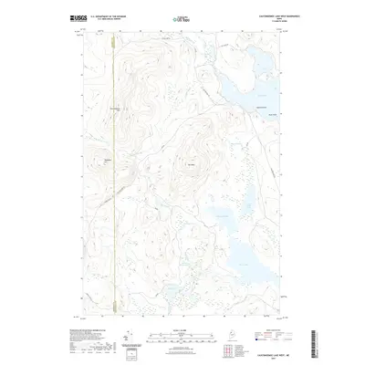
2021 Map of Caucomgomoc Lake West
USGS Topo · Published 2021About this map
The boundary between Somerset Co and Piscataquis Co bisects a high-country landscape of peaks and wetlands in northern Maine. Rising above the dense drainage networks of Middle Brook and Ramsey Brook, elevations are defined by prominent landmarks like Caucomgomoc Mtn and Telephone Hill. The region is marked by a complex system of ponds and lakes, including Loon Lake, Big Hurd Pond, and Rowe Pond, which serve as the headwaters for numerous streams. A network of logging and access roads, such as Carson Pray Rd and Caucomgomoc Rd, provides the only terrestrial connection through this remote timberland. The presence of Bear Brook Bog and various unnamed wetlands illustrates the saturated nature of the low-lying basins between the ridges of Hurd Mtn.
Find a feature on this map
29 named features on this map. Tap any name to fly to it.
Don’t see what you’re looking for? This feature index may not catch every label — zoom into the map to look around manually.
Map Details
Editions of this 2021 Caucomgomoc Lake West Map
This is the sole edition of this map. No revisions or reprints were ever made.
Other maps of this area

1954 · Baker Lake
USGS Topo · 1:62,500

1954 · Caucomgomoc Lake
USGS Topo · 1:62,500

1954 · Allagash Lake
USGS Topo · 1:62,500

1954 · St. John Pond
USGS Topo · 1:62,500

1954 · Presque Isle
USGS Topo · 1:250,000

1958 · Presque Isle
USGS Topo · 1:250,000

1958 · Caucomgomoc Lake
USGS Topo · 1:62,500

1958 · Saint John Pond
USGS Topo · 1:62,500

1960 · Presque Isle
USGS Topo · 1:250,000

1961 · Allagash Lake
USGS Topo · 1:62,500