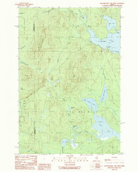
1989 Map of Caucomgomoc Lake West
USGS Topo · Published 1989About this map
Caucomgomoc Lake and Loon Lake dominate this North Woods landscape on the boundary between Somerset and Piscataquis counties. This area is characterized by heavy timber and a complex network of waterways, including Loon Stream and Hurd Brook, which connect several high-elevation water bodies like Big Hurd Pond and Little Hurd Pond. The terrain is punctuated by significant rises such as Caucomgomoc Mountain and Hurd Mtn, indicating the primitive and undeveloped nature of the region in the late 1980s.
Find a feature on this map
32 named features on this map. Tap any name to fly to it.
Don’t see what you’re looking for? This feature index may not catch every label — zoom into the map to look around manually.
Map Details
Editions of this 1989 Caucomgomoc Lake West Map
This is the sole edition of this map. No revisions or reprints were ever made.
Other maps of this area

1954 · Baker Lake
USGS Topo · 1:62,500

1954 · Caucomgomoc Lake
USGS Topo · 1:62,500

1954 · Allagash Lake
USGS Topo · 1:62,500

1954 · St. John Pond
USGS Topo · 1:62,500

1954 · Presque Isle
USGS Topo · 1:250,000

1958 · Presque Isle
USGS Topo · 1:250,000

1958 · Caucomgomoc Lake
USGS Topo · 1:62,500

1958 · Saint John Pond
USGS Topo · 1:62,500

1960 · Presque Isle
USGS Topo · 1:250,000

1961 · Allagash Lake
USGS Topo · 1:62,500