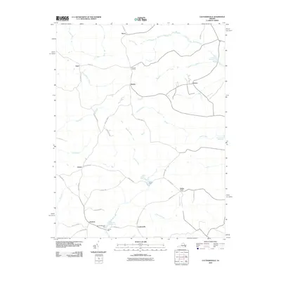
2010 Map of Cauthornville
USGS Topo · Published 2010About this map
Cauthornville and its surrounding rural landscapes are defined by an intricate network of wetlands and creek systems that have shaped local settlement for generations. The area's agricultural and industrial past is anchored by water-based landmarks like Garnett Mill and the Garnett Millpond Dam, alongside other local reservoirs such as Cheatwood Millpond and Jones Millpond. These water bodies are fed by numerous named drainages, including Hoskins Creek, Chapel Creek, and Rickenaw Creek, which weave through forested bottomlands like Root Swamp and Cook Swamp. Small, established crossroads communities such as Tignor, Owenton, Indian Neck, and Beazley are connected by a web of local roads, many of which bear descriptive names like Hell Bottom Rd and Peach Grove Rd, reflecting the distinct character of this Virginia countryside.
Find a feature on this map
43 named features on this map. Tap any name to fly to it.
Don’t see what you’re looking for? This feature index may not catch every label — zoom into the map to look around manually.
Map Details
Editions of this 2010 Cauthornville Map
This is the sole edition of this map. No revisions or reprints were ever made.
Other maps of this area

1889 · Fredericksburg
USGS Topo · 1:125,000

1892 · Fredericksburg
USGS Topo · 1:125,000

1892 · Montross
USGS Topo · 1:62,500

1894 · Fredericksburg
USGS Topo · 1:125,000

1895 · Nomini
USGS Topo · 1:125,000

1895 · Montross
USGS Topo · 1:62,500

1898 · Nomini
USGS Topo · 1:125,000

1918 · Tappahannock
USGS Topo · 1:62,500

1918 · Aylett
USGS Topo · 1:62,500

1919 · Tappahannock
USGS Topo · 1:62,500