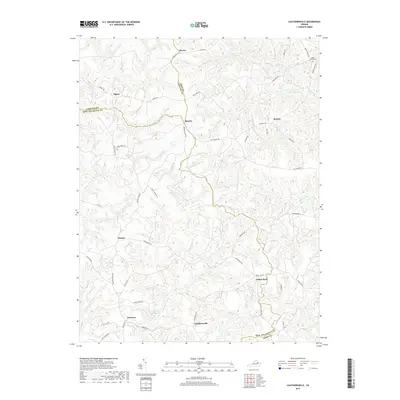
2019 Map of Cauthornville
USGS Topo · Published 2019About this map
The rural boundary between Essex, Caroline, and King and Queen Counties is defined by a landscape of extensive wetlands and small crossroad settlements. Beazley and Indian Neck anchor the central portion of this region, where the headwaters of Hoskins Cr and Chapel Cr begin their descent through the coastal plain. In the southern reaches, Cauthornville and Owenton sit amidst a network of drainage systems including Rickenaw Cr and the waters of Garnett Millpond. This map illustrates the persistence of traditional land patterns, where local life remains oriented around winding road networks like Indian Neck Rd and Lloyds Rd. The northern corner near Elevon features the Upper Essex Cem, a significant point for genealogical research. Throughout the terrain, named wetlands such as King and Queen Swamp and Root Swamp dominate the low-lying areas, highlighting the complex hydrology that historically shaped local agriculture and transportation.
Find a feature on this map
55 named features on this map. Tap any name to fly to it.
Don’t see what you’re looking for? This feature index may not catch every label — zoom into the map to look around manually.
Map Details
Editions of this 2019 Cauthornville Map
This is the sole edition of this map. No revisions or reprints were ever made.
Other maps of this area

1889 · Fredericksburg
USGS Topo · 1:125,000

1892 · Fredericksburg
USGS Topo · 1:125,000

1892 · Montross
USGS Topo · 1:62,500

1894 · Fredericksburg
USGS Topo · 1:125,000

1895 · Nomini
USGS Topo · 1:125,000

1895 · Montross
USGS Topo · 1:62,500

1898 · Nomini
USGS Topo · 1:125,000

1918 · Tappahannock
USGS Topo · 1:62,500

1918 · Aylett
USGS Topo · 1:62,500

1919 · Tappahannock
USGS Topo · 1:62,500