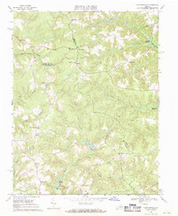
1968 Map of Cauthornville
USGS Topo · Published 1971About this map
Cauthornville and the surrounding rural communities of the Middle Peninsula are defined by a complex landscape of creek bottoms and low ridges. This late-1960s survey illustrates a region where water management and community life were closely tied, evidenced by numerous impoundments like Jones Millpond and Cheatwood Millpond. Cultural centers are marked by several rural houses of worship, including the Rappahannock Indian Ch and New Liberty Ch, which served established hamlets such as Beazley and Carneal Corners.
Find a feature on this map
30 named features on this map. Tap any name to fly to it.
Don’t see what you’re looking for? This feature index may not catch every label — zoom into the map to look around manually.
Map Details
Editions of this 1968 Cauthornville Map
2 editions found
Other maps of this area

1889 · Fredericksburg
USGS Topo · 1:125,000

1892 · Fredericksburg
USGS Topo · 1:125,000

1892 · Montross
USGS Topo · 1:62,500

1894 · Fredericksburg
USGS Topo · 1:125,000

1895 · Nomini
USGS Topo · 1:125,000

1895 · Montross
USGS Topo · 1:62,500

1898 · Nomini
USGS Topo · 1:125,000

1918 · Tappahannock
USGS Topo · 1:62,500

1918 · Aylett
USGS Topo · 1:62,500

1919 · Tappahannock
USGS Topo · 1:62,500