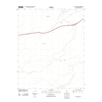
2012 Map of Cave Mountain
USGS Topo · Published 2012About this map
Cronise Valley serves as a critical desert corridor where the high-speed transit of the modern era intersects with ancient natural landmarks in the Mojave Desert. The massif of Cave Mountain dominates the central landscape, overlooking the ephemeral drainage of the Mojave River as it enters the dramatic Afton Canyon. This 2012 survey illustrates a terrain defined by water’s intermittent presence, from the dry bed of East Cronise Lake to the wide expanse of the Mojave River Wash. Transportation history is visible through the layering of desert routes, including the Arrowhead Trl and the newer highway infrastructure that parallels it. The map provides a detailed look at the geographic transition between the Cronise Mountains and the lower Basin, where seasonal drainages like Baxter Wash carve through the arid valley floor.
Find a feature on this map
12 named features on this map. Tap any name to fly to it.
Don’t see what you’re looking for? This feature index may not catch every label — zoom into the map to look around manually.
Map Details
Editions of this 2012 Cave Mountain Map
This is the sole edition of this map. No revisions or reprints were ever made.
Other maps of this area

1933 · Avawatz Mountains
USGS Topo · 1:250,000

1947 · Trona
USGS Topo · 1:250,000

1948 · Trona
USGS Topo · 1:250,000

1948 · Cave Mountain
USGS Topo · 1:62,500

1951 · Cave Mountain
USGS Topo · 1:62,500

1953 · San Bernardino
USGS Topo · 1:250,000

1953 · Trona
USGS Topo · 1:250,000

1955 · Cady Mountains
USGS Topo · 1:62,500

1955 · Broadwell Lake
USGS Topo · 1:62,500

1956 · San Bernardino
USGS Topo · 1:250,000