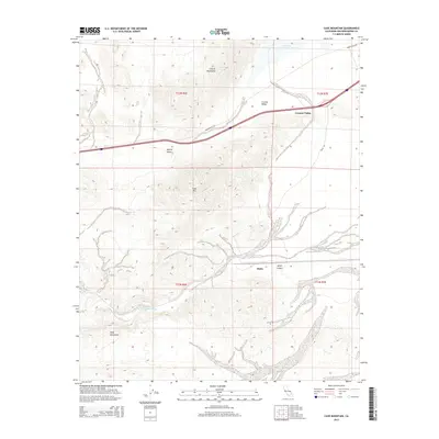
2015 Map of Cave Mountain
USGS Topo · Published 2015About this map
The Mojave River carves through the arid landscape of San Bernardino County, marking a vital corridor through the Mojave Desert. This 2015 study details the complex topography where the Cronise Mountains and Cave Mtn meet the sweeping floor of the Cronese Valley. To the south, the Cady Mountains overlook the dramatic transition into Afton Canyon, a site of significant geological and historical interest where the river has historically shaped human passage through the region.
Find a feature on this map
19 named features on this map. Tap any name to fly to it.
Don’t see what you’re looking for? This feature index may not catch every label — zoom into the map to look around manually.
Map Details
Editions of this 2015 Cave Mountain Map
This is the sole edition of this map. No revisions or reprints were ever made.
Other maps of this area

1933 · Avawatz Mountains
USGS Topo · 1:250,000

1947 · Trona
USGS Topo · 1:250,000

1948 · Trona
USGS Topo · 1:250,000

1948 · Cave Mountain
USGS Topo · 1:62,500

1951 · Cave Mountain
USGS Topo · 1:62,500

1953 · San Bernardino
USGS Topo · 1:250,000

1953 · Trona
USGS Topo · 1:250,000

1955 · Cady Mountains
USGS Topo · 1:62,500

1955 · Broadwell Lake
USGS Topo · 1:62,500

1956 · San Bernardino
USGS Topo · 1:250,000