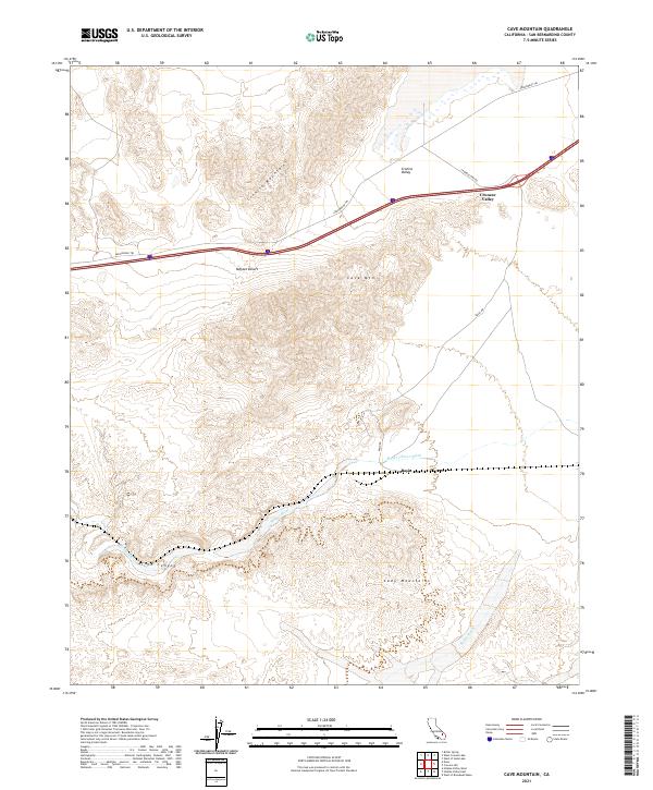
2021 Map of Cave Mountain
USGS Topo · Published 2021About this map
Afton Canyon and the surrounding desert peaks define this segment of the Mojave Desert corridor. The geography is dominated by the Mojave River as it passes through the mountain gaps, leaving the Mojave River Wash as a primary landform. To the north, the Cronise Mountains overlook the Cronise Valley, where historical transportation routes converge. The map documents the persistent alignment of the Arrowhead Trl and the Basin railroad siding, illustrating the long-standing transit infrastructure required to navigate this arid basin-and-range environment. The southern portion is anchored by the Cady Mountains, where Baxter Wash drains toward the central river valley, showing a landscape shaped by intermittent water and high-relief terrain around Cave Mtn.
Find a feature on this map
17 named features on this map. Tap any name to fly to it.
Don’t see what you’re looking for? This feature index may not catch every label — zoom into the map to look around manually.
Map Details
Editions of this 2021 Cave Mountain Map
This is the sole edition of this map. No revisions or reprints were ever made.
Other maps of this area

1933 · Avawatz Mountains
USGS Topo · 1:250,000

1947 · Trona
USGS Topo · 1:250,000

1948 · Trona
USGS Topo · 1:250,000

1948 · Cave Mountain
USGS Topo · 1:62,500

1951 · Cave Mountain
USGS Topo · 1:62,500

1953 · San Bernardino
USGS Topo · 1:250,000

1953 · Trona
USGS Topo · 1:250,000

1955 · Cady Mountains
USGS Topo · 1:62,500

1955 · Broadwell Lake
USGS Topo · 1:62,500

1956 · San Bernardino
USGS Topo · 1:250,000