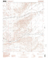
1996 Map of Cave Mountain
USGS Topo · Published 2000About this map
Cave Mountain and the surrounding desert peaks dominate this 1996 aerial survey, where the arid landscape is defined by the ephemeral passage of water. The Mojave River Wash and the Mojave River itself snake through the canyon floor, following a path between the Cady Mountains and the northern ranges. Small outposts at Afton and Baxter mark the thin human footprint in this corner of San Bernardino County, while the northern edge of the map opens into the dry bed of Cronise Lake.
Find a feature on this map
17 named features on this map. Tap any name to fly to it.
Don’t see what you’re looking for? This feature index may not catch every label — zoom into the map to look around manually.
Map Details
Editions of this 1996 Cave Mountain Map
This is the sole edition of this map. No revisions or reprints were ever made.
Other maps of this area

1933 · Avawatz Mountains
USGS Topo · 1:250,000

1947 · Trona
USGS Topo · 1:250,000

1948 · Trona
USGS Topo · 1:250,000

1948 · Cave Mountain
USGS Topo · 1:62,500

1951 · Cave Mountain
USGS Topo · 1:62,500

1953 · San Bernardino
USGS Topo · 1:250,000

1953 · Trona
USGS Topo · 1:250,000

1955 · Cady Mountains
USGS Topo · 1:62,500

1955 · Broadwell Lake
USGS Topo · 1:62,500

1956 · San Bernardino
USGS Topo · 1:250,000