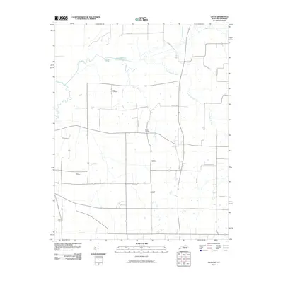
2010 Map of Cayce
USGS Topo · Published 2010About this map
Bayou de Chien and its tributary Little Bayou de Chien meander through this landscape along the Kentucky-Tennessee border, defining a region where water and land ownership are deeply intertwined. The map reveals a dense network of family-named roads and burial grounds, providing a clear picture of the rural community structure in the early 21st century. Genealogists will find the locations of Roper Cemetery, McGee Cemetery, Johnson Cemetery, Bacon Cemetery, and Alexander Cemetery essential for tracing local lineage. The southern edge of the survey is anchored by the settlement of State Line, where State Line Rd marks the political boundary. Wetland features like Cornwall Pond, Halfmoon Pond, and Rush Creek illustrate the low-lying drainage patterns characteristic of this riverine territory north of the Obion River system.
Find a feature on this map
28 named features on this map. Tap any name to fly to it.
Don’t see what you’re looking for? This feature index may not catch every label — zoom into the map to look around manually.
Map Details
Editions of this 2010 Cayce Map
This is the sole edition of this map. No revisions or reprints were ever made.
Other maps of this area

1939 · Hickman
USGS Topo · 1:62,500

1951 · Cayce
USGS Topo · 1:24,000

1951 · Oakton
USGS Topo · 1:24,000

1951 · Hickman
USGS Topo · 1:24,000

1951 · Wolf Island
USGS Topo · 1:24,000

1952 · Clinton
USGS Topo · 1:24,000

1952 · Crutchfield
USGS Topo · 1:24,000

1952 · Water Valley
USGS Topo · 1:62,500

1954 · Union City
USGS Topo · 1:24,000

1954 · Hickman
USGS Topo · 1:62,500