
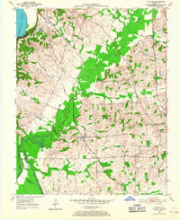
1951 Map of Oakton
USGS Topo · Published 1952About this map
Mississippi River frontage and the dissected bluffs of Hickman and Fulton counties define this western Kentucky landscape in the early 1950s. The terrain is shaped by the transition from the river bottomlands to the uplands, where the Mobile and Ohio and Illinois Central railroads provided critical transport for the agricultural community. Small settlements such as Oakton and South Columbus serve as focal points for the surrounding rural road network, while places like Greenville Crossing and Whaynes Corner highlight the localized nature of mid-century commerce and transit.
Find a feature on this map
23 named features on this map. Tap any name to fly to it.
Don’t see what you’re looking for? This feature index may not catch every label — zoom into the map to look around manually.
Map Details
Editions of this 1951 Oakton Map
2 editions found
Other maps of this area

1939 · Wickliffe
USGS Topo · 1:62,500

1939 · Hickman
USGS Topo · 1:62,500

1951 · Cayce
USGS Topo · 1:24,000

1951 · Hickman
USGS Topo · 1:24,000

1951 · Wolf Island
USGS Topo · 1:24,000

1951 · Wickliffe SW
USGS Topo · 1:24,000

1951 · Arlington
USGS Topo · 1:24,000

1951 · Milburn
USGS Topo · 1:24,000

1952 · Clinton
USGS Topo · 1:24,000

1952 · Crutchfield
USGS Topo · 1:24,000