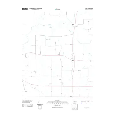
2013 Map of Cayce
USGS Topo · Published 2013About this map
Moscow and Cayce anchor the high ground above the complex wetlands of the Bayou de Chien drainage system in this portion of Hickman County. The landscape is defined by its watercourses, including Little Bayou de Chien, Rush Cr, and Hurricane Br, which wind through the terrain near the Kentucky-Tennessee State Line. Agricultural and family heritage is evident in the numerous small burial grounds scattered across the quadrangle, such as Roper Cem, McGee Cem, and Bacon Cem. Aviation history is represented by the Alexander Field Airport located south of Cayce. To the north, Cornwall Pond and Halfmoon Pond sit within the bottomlands, illustrating the wet, low-lying character of the region. The road network connecting these rural settlements includes historic routes like Roper School Rd and Sylvan Shade School Rd, reflecting the community's local infrastructure.
Find a feature on this map
48 named features on this map. Tap any name to fly to it.
Don’t see what you’re looking for? This feature index may not catch every label — zoom into the map to look around manually.
Map Details
Editions of this 2013 Cayce Map
This is the sole edition of this map. No revisions or reprints were ever made.
Other maps of this area

1939 · Hickman
USGS Topo · 1:62,500

1951 · Cayce
USGS Topo · 1:24,000

1951 · Oakton
USGS Topo · 1:24,000

1951 · Hickman
USGS Topo · 1:24,000

1951 · Wolf Island
USGS Topo · 1:24,000

1952 · Clinton
USGS Topo · 1:24,000

1952 · Crutchfield
USGS Topo · 1:24,000

1952 · Water Valley
USGS Topo · 1:62,500

1954 · Union City
USGS Topo · 1:24,000

1954 · Hickman
USGS Topo · 1:62,500