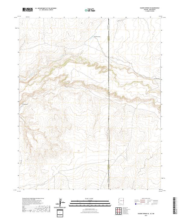
2021 Map of Ceadro Spring SE
USGS Topo · Published 2021About this map
The Zuni River meanders across the high-altitude landscape where the border between Arizona and New Mexico meets the dividing line of Apache and Cibola counties. This arid terrain is defined by a complex network of seasonal drainages, including the prominent Jaralosa Draw and Venadito Draw, which cut through the plateau country. The survey captures a sparsely populated region primarily utilized for service routes and ranching, evidenced by the presence of Indian Svc Rte 17 in the northern portion of the quadrangle. A notable topographic landmark identified as Bear Claw stands out along the western edge, illustrating the descriptive naming conventions typical of this borderland area. The map provides a precise view of the Public Land Survey System grids, showing the intersection of townships and ranges that historically governed land allotment in this remote corner of the American Southwest.
Find a feature on this map
14 named features on this map. Tap any name to fly to it.
Don’t see what you’re looking for? This feature index may not catch every label — zoom into the map to look around manually.
Map Details
Editions of this 2021 Ceadro Spring SE Map
This is the sole edition of this map. No revisions or reprints were ever made.
Other maps of this area

1886 · St Johns
USGS Topo · 1:250,000

1892 · St Johns
USGS Topo · 1:250,000

1954 · Saint Johns
USGS Topo · 1:250,000

1957 · Saint Johns
USGS Topo · 1:250,000

1958 · Saint Johns
USGS Topo · 1:250,000

1962 · Saint Johns
USGS Topo · 1:250,000

1972 · Cantaralo Spring
USGS Topo · 1:24,000
1972 · Ojo Caliente Reservoir
USGS Topo · 1:24,000
1972 · Venadito Camp
USGS Topo · 1:24,000
1977 · Ceadro Spring
USGS Topo · 1:24,000