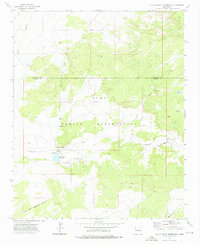
1972 Map of Ojo Caliente Reservoir
USGS Topo · Published 1976About this map
The Zuni Indian Reservation landscape is defined by its vital water sources in an arid high-desert environment. The settlement of Ojo Caliente sits at the nexus of several seasonal drainages, most notably the Plumasano Wash and the Zuni River which enters from the northwest corner. This 1970s survey captures the region's hydrography before modern changes, centered on the Ojo Caliente Reservoir and several named water points such as Rainbow Spring and Sacred Spring. The terrain is characterized by broad washes like Willow Wash and prominent landforms such as Red Mesa to the east. An Old Indian Reservation Boundary cuts across the southern portion of the map, while the northern section is bisected by the McKinley Co Valencia Co line, illustrating the intersection of cultural, political, and natural borders.
Find a feature on this map
14 named features on this map. Tap any name to fly to it.
Don’t see what you’re looking for? This feature index may not catch every label — zoom into the map to look around manually.
Map Details
Editions of this 1972 Ojo Caliente Reservoir Map
This is the sole edition of this map. No revisions or reprints were ever made.
Other maps of this area

1886 · St Johns
USGS Topo · 1:250,000

1886 · Wingate
USGS Topo · 1:250,000

1886 · Fort Defiance
USGS Topo · 1:250,000

1892 · Fort Defiance
USGS Topo · 1:250,000

1892 · St Johns
USGS Topo · 1:250,000

1892 · Wingate
USGS Topo · 1:250,000

1954 · Saint Johns
USGS Topo · 1:250,000

1954 · Gallup
USGS Topo · 1:250,000

1957 · Saint Johns
USGS Topo · 1:250,000

1958 · Gallup
USGS Topo · 1:250,000