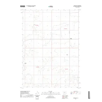
2017 Map of Cedar Butte
USGS Topo · Published 2017About this map
The Devils Backbone and Devils Gate define the dramatic topography of this Mellette County landscape. This 2017 survey captures the Cedar Butte settlement area during a period of modern land management within the Swift Bear Segment. The sparse human footprint is centered around Cedar Butte Rd and the Cedarbutte Cem, which serves as a vital anchor for local genealogical research and family history. Most of the terrain remains dominated by natural drainage patterns, notably the winding path of N Br Pine Cr, which carves through the high plains. The map provides a clear look at the Public Land Survey System grid, including the intersection of t42n r32w and t42n r31w, illustrating how section lines continue to organize this open country.
Find a feature on this map
11 named features on this map. Tap any name to fly to it.
Don’t see what you’re looking for? This feature index may not catch every label — zoom into the map to look around manually.
Map Details
Editions of this 2017 Cedar Butte Map
This is the sole edition of this map. No revisions or reprints were ever made.
Other maps of this area

1951 · Cedar Butte NW
USGS Topo · 1:24,000

1951 · Cedar Butte NE
USGS Topo · 1:24,000

1951 · Murdo 3 NW
USGS Topo · 1:24,000

1955 · Martin
USGS Topo · 1:250,000

1958 · Martin
USGS Topo · 1:250,000

1969 · Norris
USGS Topo · 1:24,000

1969 · Parmelee NE
USGS Topo · 1:24,000

1969 · Soldier Creek NW
USGS Topo · 1:24,000

1980 · Kadoka
USGS Topo · 1:100,000

1981 · Cedar Butte
USGS Topo · 1:25,000
Featured Places
- Swift Bear Segment, SD
- Cedar Butte, SD
- Corn Creek Segment, SD
- Horse Creek Segment, SD
- Black Pipe Segment, SD