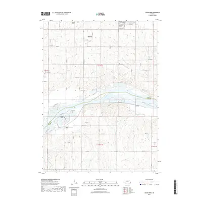
2017 Map of Cedar Creek
USGS Topo · Published 2017About this map
The Platte River forms the central geographic axis of this Sarpy and Cass County landscape, marking the transition between the rolling uplands of Richfield and the lower river plains near Cedar Creek. To the north, the southern edges of Papillion show residential development through streets like Swallowtail St and Leawood St, while institutions like Nebraska Christian College anchor the local community.
Find a feature on this map
51 named features on this map. Tap any name to fly to it.
Don’t see what you’re looking for? This feature index may not catch every label — zoom into the map to look around manually.
Map Details
Editions of this 2017 Cedar Creek Map
This is the sole edition of this map. No revisions or reprints were ever made.
Other maps of this area

1893 · Fremont
USGS Topo · 1:125,000

1896 · Fremont
USGS Topo · 1:125,000

1903 · Weeping Water
USGS Topo · 1:125,000

1929 · Weeping Water
USGS Topo · 1:125,000

1935 · Nehawka
USGS Topo · 1:48,000

1940 · Nehawka
USGS Topo · 1:62,500

1954 · Omaha
USGS Topo · 1:250,000

1955 · Fremont
USGS Topo · 1:250,000

1955 · Nebraska City
USGS Topo · 1:250,000

1955 · Lincoln
USGS Topo · 1:250,000