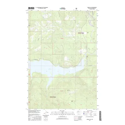
2017 Map of Cedar Flats
USGS Topo · Published 2017About this map
Swift Reservoir dominates the central landscape of this Skamania County region, serving as a primary hydrologic feature where the Lewis River and Muddy River converge. The terrain is defined by the sharp elevations of Marble Mtn in the northwest and McClellan Mtn to the south, framing a heavily forested environment within the Gifford Pinchot National Forest. While the topography is steep, small levelings like Cedar Flats and Paradise Valley offer distinct breaks in the forest canopy. The map documents an extensive network of forest development roads, such as Nat For Dev Rd 90 and Nat For Dev Rd 8320, which provide access to the remote backcountry and the prominent Eagle Cliffs overlooking the river valley.
Find a feature on this map
39 named features on this map. Tap any name to fly to it.
Don’t see what you’re looking for? This feature index may not catch every label — zoom into the map to look around manually.
Map Details
Editions of this 2017 Cedar Flats Map
This is the sole edition of this map. No revisions or reprints were ever made.
Other maps of this area

1919 · Mount St Helens
USGS Topo · 1:125,000

1926 · Steamboat Mtn
USGS Topo · 1:125,000

1926 · Hood River
USGS Topo · 1:125,000

1929 · Hood River
USGS Topo · 1:125,000

1931 · Steamboat Mtn
USGS Topo · 1:125,000

1940 · Lookout Mtn
USGS Topo · 1:62,500

1948 · Vancouver
USGS Topo · 1:250,000

1950 · Vancouver
USGS Topo · 1:250,000

1950 · Vancouver
USGS Topo · 1:250,000

1950 · Yakima
USGS Topo · 1:250,000