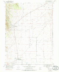
1975 Map of Cedar Fort
USGS Topo · Published 1986About this map
Cedar Fort and the nearby settlement of Fairfield anchor this mid-1970s survey of the western Cedar Valley floor. The landscape preserves significant echoes of Utah's mid-19th-century military and frontier history, most notably at the Stage Coach Inn State Historical Site and Camp Floyd State Historical Site. These markers sit at the valley's southern edge near Big Spring, where the former Johnston’s Army once maintained its largest frontier outpost.
Find a feature on this map
23 named features on this map. Tap any name to fly to it.
Don’t see what you’re looking for? This feature index may not catch every label — zoom into the map to look around manually.
Map Details
Editions of this 1975 Cedar Fort Map
This is the sole edition of this map. No revisions or reprints were ever made.
Other maps of this area

1885 · Salt Lake
USGS Topo · 1:250,000

1885 · Tooele Valley
USGS Topo · 1:250,000

1915 · Fairfield
USGS Topo · 1:62,500

1917 · Fairfield
USGS Topo · 1:62,500

1947 · Fivemile Pass
USGS Topo · 1:62,500

1947 · Goshen Pass
USGS Topo · 1:24,000

1949 · Fivemile Pass
USGS Topo · 1:24,000

1949 · Goshen Pass
USGS Topo · 1:24,000
1950 · Soldiers Pass
USGS Topo · 1:24,000
1950 · West Mountain
USGS Topo · 1:62,500