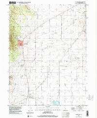
1997 Map of Cedar Fort
USGS Topo · Published 2001About this map
Cedar Valley opens between the Oquirrh Mountains and Long Ridge in this late-1990s survey of Utah County. The landscape preserves layers of pioneer and transportation history, specifically at Fairfield, where the Stage Coach Inn State Historical Site and Camp Floyd State Historical Site mark the location of a major mid-19th century military encampment and transit hub. The Historic Pony Express National Trail and several stretches of Old Railroad Grade track across the valley floor, illustrating the corridor's long-standing role as a vital western passage.
Find a feature on this map
34 named features on this map. Tap any name to fly to it.
Don’t see what you’re looking for? This feature index may not catch every label — zoom into the map to look around manually.
Map Details
Editions of this 1997 Cedar Fort Map
This is the sole edition of this map. No revisions or reprints were ever made.
Other maps of this area

1885 · Salt Lake
USGS Topo · 1:250,000

1885 · Tooele Valley
USGS Topo · 1:250,000

1915 · Fairfield
USGS Topo · 1:62,500

1917 · Fairfield
USGS Topo · 1:62,500

1947 · Fivemile Pass
USGS Topo · 1:62,500

1947 · Goshen Pass
USGS Topo · 1:24,000

1949 · Fivemile Pass
USGS Topo · 1:24,000

1949 · Goshen Pass
USGS Topo · 1:24,000
1950 · Soldiers Pass
USGS Topo · 1:24,000
1950 · West Mountain
USGS Topo · 1:62,500